Thursday, March 5, 2015

Weather Problems outbound Feb 16

We had purchased tickets to fly to Los Angeles from Dulles on February 17. By Feb 15, there was a winter storm watch for the entire metro area covering the time of our flight. 

We changed our flight to Feb 16. It cost more than twice what we paid for our original ticket. I detected a note of extortionate glee in the voice of the United employee who made the change.

 Sure enough it did snow (see image - it wasn't very deep at Dulles) and the flight originally booked was cancelled. People who made it to the airport on time got a free change in booking but we could not have made use of this as the cruise ship would have sailed without us.

In LAX vicinity Feb 16-17

We booked a room at a Travelodge just south of the airport. Travelodge must be doing pretty well because the van that picked us up was made by Mercedes.

We had a lot of time so I went for a walk, bought some food at a supermarket (Ralph's) and got a haircut at a place called 'Sports Clips'. This is a barber shop where, while you wait for a barber and then as you are getting a haircut, you can watch a large screen TV preset to ESPN or the NFL channel.

I hadn't seen this type of barber shop before but it seems that two of their outlets are in Gaithersburg, MD.

Feb 17 All Aboard

 We went back to the airport, found the Grand Princess staff, gave them our luggage and got into a shuttle bus that went to San Pedro (a.k.a., the Port of Long Beach and Los Angeles).  

One of the ships docked on the passenger side of the port was the USS Iowa, a WWII battleship. 

Next to it was the Grand Princess, a 2500 passenger cruise ship. We went through the usual ingest procedures and boarded the Princess. 

When we got aboard we went to the 14th deck and had some iced tea (nice weather) and watched some loading on the freight side and then watched as our ship left the port. 

Then we went to our stateroom on deck 11 (there is no deck 13) and sure enough, the luggage was there. After unpacking we went back up to deck 14 and found something to eat.


Late Feb 17 to am Feb 22 At Sea

We had a lot of time to relax during this period.

The ship carried about 20 TV channels. One had constant episodes of the "Love Boat" which was named the Pacific Princess and was the putative scene of a TV show that ran for many years in the 1980s. The boat, which carried 600 passengers (vs 2500 for the boat we were on) was sold to Quail Cruises in the 1990s. It took its final journey in August 2013 and was dismantled for scrap (image purports  to show the boat on its last voyage). The Princess line was incorporated in 1965, so this was its 50th year of operation.
 
They also had a channel with taped on board activities so if you missed a lecture or event, you could see it in your cabin. We saw a movie on deck 15 lying on beach lounges and covered with blankets. 

We also went to some of the shows. One we both like was a guitarist comedian named, Steve Moris (he is the overweight guy in the middle and, yes he made fun of himself as well as making a lot of 'oldies jokes). 
 
There was a head waiter who had taken training in kosher foods and the dining staff had apparently had a meeting specifically about how to serve our food (or it might have been an agenda item at a meeting). They only had a limited selection of kosher wine on hand. We had brought a bottle of Barkan Merlot for the Sabbath (Barkan is served at many functions that I attend with caterers).  I let the headwaiter have some and he said, they would try to stock it in the future (Wine, beer and whiskey are marked up a lot on board).


Hilo Waterfalls Feb 22


After about 2300 miles of sailing, the ship entered Hilo Bay on Feb 22.  On the map (from internet), Hilo Bay is the little inlet on the northeast coast.  I had decided not to see the volcano area because I had already seen it and after a while, all black lava looks pretty much alike. 


Instead we had a tour which began with some waterfalls, a bit to the northwest of Hilo Bay. The second and third images are of the Akaka waterfall. (on images taken by me, you can get a bigger picture by clicking once and an even bigger picture by clicking twice; this also works on some of the other images). It was a pretty good hike from where the picture of Ann was taken to where the photo of me was taken (too many stairs for her). The waterfall is over 420'. At the area near where my image was taken, there was a small cat. Cats are said to be all over the Islands but that was the only one I saw during the trip.

 
After Akaka falls, there is another waterfall near by and I went near it (image is from the internet). It is also about 400' and called Kahuna Falls. By an odd coincidence, Kahuna means 'priest' (or important spiritual expert) in Hawaiian and means 'High Priest' in biblical Hebrew.                                .

Hilo Zoo Feb 22

The zoo in Hilo had just lost their prized white striped tiger a month or so before we got there.  They were in the process of adding an alligator exhibit but hadn't finished the work.


To be honest, the zoo isn't really that good, although having alligators is sure to liven it up a bit.

The first image shows us with some ring tailed lemurs.
 

The second image shows a peacock whose display was caught by the wind. 

It was in the 70sF and windy with off and on showers in Hilo (which is pretty normal weather for them).

Nuts and Nut trees and other trees Feb 22


 Hawaii has lots of trees.

One of the trees is the coconut tree. It produces a fruit (actually a fibrous single seed drupe). Accidents have happened and people have brought lawsuits after being bonked on the head. Hence the sign on the bottom of the tree in image 1.

Banyan trees have been planted along the scenic drives in several islands. The banyan is enormous and grows from branches. The one in image 2 (from the internet) was planted by Babe Ruth (other famous people  planted banyan trees as well).

The third image is a macadamia tree. We went to a macadamia nut factory on this tour. Hersheys owns the factory (but a trust of some sort owns the trees). This is about the only profitable agriculture still in Hawaii as almost all the pineapples and sugar cane plantations have been abandoned (some are still in operation to preserve the low taxes for farm land while hoping to eventually sell the land for development).    

In and about Oahu Feb 23

After about a 250 mi sail from the port of Hilo. We arrived at the port of Honolulu. Honolulu is on the south of the Island of Oahu.


We got a bus ride to the Waikiki Beach area. 
  

Then we took a shuttle boat out to where the submarines were working. The second image is of Ann on the shuttle boat with Oahu in the background.                

The third image is Ann and Michelangelo (yes we take a stuffed animal with us on many of our trips, including the cruises - Michelangelo has other pictures cross posted on the stuffed animal blog).  They are getting off the shuttle boat and onto the submarine.

The submarine goes down to about 120' below the ocean surface.  

The submarine has windows to look out of and see the fishes and reefs and so on (fourth image). The company that operates the submarines has sunk some boats in the waters in this area to provide artificial reefs because it makes the ride more interesting (many fish like reefs because it gives them some protection against predator fish).


The light in the submarine looks blue because of a color distortion that happens when you are that far below the ocean floor.  The only light in the sub is the natural light and the water above the sub attenuates the longer wavelengths (red light has a longer wavelength, about 650 nanometers, than blue, which is about 480 nanometers).

The final image shows the submarine fully surfaced.  


In and about Kauai - Feb 24

It was about 100 miles from Oahu to Kauai. The ship docked at the port of Nawiliwili (means 'the place of wiliwili trees'; wiliwili trees are the state tree of Hawaii, the wood is light in density which makes it good for making surfboards and its seeds don't spoil, are a powerful laxative, and, can be stacked and burned and made into a type of candle) on the east side of the island.  We got onto the shore excursion bus and went to the Grand Canyon of Hawaii (Mark Twain named it). 

This is a canyon made by the Waimea River. In the image we are at about 4000' and the canyon is about 2000' deep. We are on the west side of the island but the east side of the canyon. 

This canyon is only about 5 million years old (the Grand Canyon in Arizona is 17 million years old). At the top of the west side of the canyon that is a plateau with elevation about 4000' and is known as the Pihea-Alakai swamp. If classified as a swamp, it would be the world's highest. however, most botanists would classify it as a high elevation bog. 

The image of Ann is at Twin Falls, aka Opaekaa falls, near the Wailua River.

The next image of Ann is at the fern grotto. This is near the Wailua River on the east side of the island.


This site has had changes due to weather. In 1992, Hurricane Iniki tore out all the existing vegetation. Then in March and April 2006, a 40 day rainstorm (one site on the island got 92" of rain in March 2006) washed a lot of boulders into the grotto. The people in the picture are on a wooden deck built over the boulders.

The Wailua River is the site of dozens of movies (actually scenes of movies), e.g. Supergator (a made for Syfy channel film in 2007), Raiders of the Lost Ark (1981) and, notably, Blue Hawaii (a 1961 Elvis film). 
 
In the film there is a scene in which Chadwick Gates (played by Elvis) is handed a conch shell. The guy who handed the conch shell in that film is now a local celebrity of sorts and was one of the musicians who played for us on the boat up and down the river.


The next image shows the kind of boat we took up and down the Wailua River.  


By this point, I had asked several of the guides on our shore excursions, the following question, 
"Where do Hawaiians go for vacation?" 

The answer was mostly, 

"Las Vegas" 


That is metaphorically like saying that if you live in Gan Eden (a.k.a., Paradise', a.k.a., the 'Garden of Eden') you vacation in Sodom.


Maui - Feb 25 - Haleakala

We cruised about 200 miles east from Kaui (our furthest west point on the cruise) to the port of Lahaina on the west side of Maui.  This port wasn't deep enough for the ship to go all the way to the dock so we had to take tenders to shore.   
 Our first destination was the rim of Haleakala. The rim is at about 10,000'. The bus stopped a few times. The first picture of Ann and me is at about 5000'. From this viewpoint you can see the entire isthmus between the south (a bit left of the pole) and the north shore (just to the right of my left shoulder) on the west side. The mountains on west Maui rise to about 5500'. The island has started to sink and in about 100000 years, the isthmus will be under water and Maui will be two islands.


At about the 8000' level we passed a bus of other tourists from our cruise. That bus had blown something and diesel smoke was coming out the back. They did get a substitute bus. 

Also, the National Park service now forbids bicycles from going all the way to the top of the rim. Thus the ride I took on a bicycle from the rim to sea level in 1993 is no longer done by anyone.


The two images of the crater (one with me and Ann, one with Ann make the crater seem small. Actually it is about the same size as the island of Manhattan. Also, the crater is not geologically a crater but an eroded valley where a crater once was (the sides of the mountain have tumbled into the crater). This has happened over the past 2 million years as Haleakala has been eroded from about 15,000' to about 10,000'.


In this looking-east image with no people, you can see Mauna Kea (the mountain looks blue) above the clouds just to the left of one of the peaks of Haleakala. Mauna Kea is about 80 miles away. That's my image but others have done it better. For example see Summit post here.

The image of Ann is looking west from Haleakala shows the south shore of west Maui and two islands. These are Kaho'olawe on the left and Lanai on the right (Lanai is about 40 miles away).  Up until about 1 million years ago, these islands, as well as Oahu were connected to Maui but there base has been sinking.

The last image shows the Haleakala silversword, a rare plant which only grows in the wild above about the 7000' level on this mountain. It is a member of the daisy family.  Coincidently, on March 15, 2015, the comic strip 'Mark Trail' had a strip completely devoted to this plant.


Maui Feb 25 in the Isthmus

 The bus went down the mountain and we saw the rescue bus for the one that had the diesel smoke.     

 
We went past the only remaining commercial sugar cane and grapefruit in Hawaii (it is in the Isthmus) and some settlements and wound up for lunch at a place called 'The Tropical Plantation', essentially the same name as the place we went to in Kawai.


The first image shows the wind blowing from the north and the mountains of west Maui in the background (those mountains get over 100" of rain a year). 


The second image shows about the same thing about a minute later, but with the wind calm (that's how fast it changes). 


The third and fourth image show me near a pond that has been decorated with gears formerly used to grind sugar cane. 


Ann was busy shopping (these places are specifically laid out to get people feeling good about the scenery and then have lots of touristy items for sale) so I had some woman from our tour group take the pictures. 
 
I started to tell her where to stand and where I was going to stand but she said, "stop talking like a husband, I'll just take the pictures."

From Maui to Ensenada late PM Feb 25 to am Mar 3


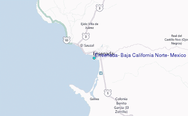
It was about 2500 miles between Maui and
Ensenada and the current and the wind were in the opposite direction from the direction the ship was traveling.

That's way it took 5 full days at sea (and parts of two other days) to get to Ensenada.  

 The first image is Ann with a towel dog that the cabin steward made.

We had a good time just relaxing, dining, seeing movies, etc. The waves were up to 10' at times and that turned the pools into wave pools - I had a good time in them. 


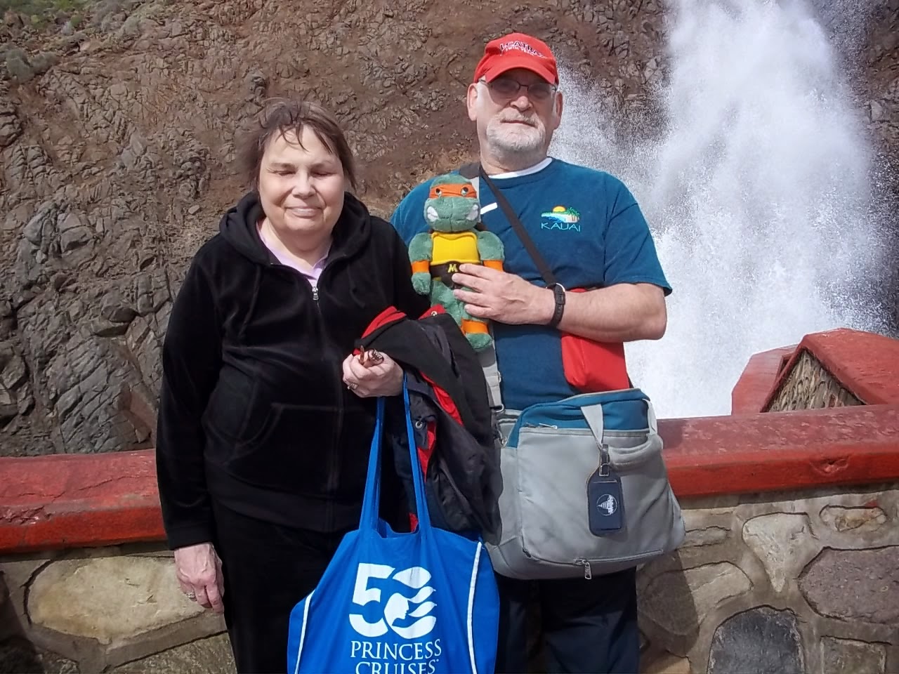
The second image is of Ann and me on one of the three 'formal nights'. The image was taken by the wife of a guy from Scotland whose formal attire included a kilt.


The third image is a view of how the outside movie theater is set up on decks 14 and 15 (from the internet). Actually, there are three movie theaters on the ship (the other two are on deck 7).  

On one of our shore excursions, I had worn the sheepshead shirt and some people from Wisconsin asked me about it. 
I found out there were three couples from the Oshkosh area that had booked the cruise together and were playing sheepshead on days at sea. 
One day at sea, one of the couples couldn't play and I made up a 5-handed game with the other two couples. Ironically, on one hand I had, post picking, all four queens, just like the emblem on the shirt.

Ensenada March 3

Ensenada is about 50 miles south of San Diego.  It was on the cool side in Ensenada in the am (about 50F) although it warmed up a bit in the day.

Our first stop was La Bufadora (aka, the blowhole) at the end of the little peninsula that sticks out into the Pacific south of the city itself (see map).  A major blowhole is a hole near the ocean where waves are channeled into a narrow tunnel then water blows upward more than 5 feet, like a geyser through a hole in the surface. 

There are three clusters of major blowholes in the world. We saw two of them on this trip, one in Hawaii on the island of Kauai and this one in Mexico. The one in Mexico is, by far, the more spectacular. There is also one in Australia. We took Michelangelo on this shore excursion.  On the top left, under the map, Mikey is looking at the blowhole. It was shooting up at least 60' and a few times per minute. 

The next image shows Ann, Mikey and me in front of a viewing area (its a bit farther from the blowhole than the first image). As in another post, this image is cross posted on the stuffed animal blog.


A long retail corridor, like a middle eastern souk (or shouk), has grown up between where the buses leave off passengers and where the blowhole is. There are people offering free samples of pina coladas and there are dozens and dozens of shops to buy food, blankets, silver ornaments, etc. Ann bought some silver and a blanket.

The next thing we did was go into downtown Ensenada and visit the convention center which was formerly a casino and before that a hotel. 


The place has considerable charm. One of the interesting details in the center is the carved and painted wooden ceilings (last image). There are quite a few of these each of which has a different configuration and design details.

They also had free beer (Corona) and margaritas. Of course, after the beer there was another retail area to wander though on the way back to the bus. 

Speaking of weather, it turned out that, as cool as it was in Ensenada that day, it was significantly cooler in the LA area and in fact, some parts of LA, even Rodondo Beach, had a coating of snow.